If the massive 9.0 earthquake that is predicted along the Cascadia Subduction Zone, known as the Big One, were to strike today, Jefferson County could become cut off from the mainland of Washington.
This item is available in full to subscribers.
We have recently launched a new and improved website. To continue reading, you will need to either log into your subscriber account, or purchase a new subscription.
If you had an active account on our previous website, then you have an account here. Simply reset your password to regain access to your account.
If you did not have an account on our previous website, but are a current print subscriber, click here to set up your website account.
Otherwise, click here to view your options for subscribing.
* Having trouble? Call our circulation department at 360-385-2900, or email our support.
Please log in to continue |
|
If the massive 9.0 earthquake that is predicted along the Cascadia Subduction Zone, known as the Big One, were to strike today, Jefferson County could become cut off from the mainland of Washington.
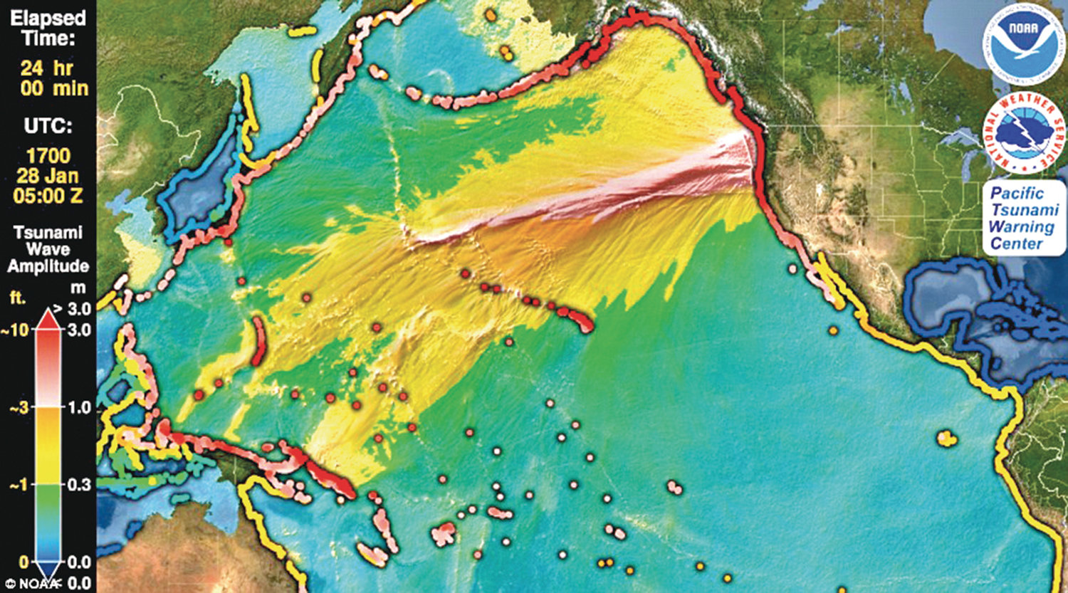
The Cascadia Subduction Zone is the largest active fault that affects the Pacific Northwest, according to the Jefferson County Department of Emergency Management (JCDEM). Sitting 60 miles off of the Pacific Coast, it is capable of producing some of the largest and most damaging earthquakes in the world. It is the only significant fault along the Ring of Fire with no major quake activity in the last 50 years.
“A damaging earthquake is inevitable on this fault, but we do not know exactly when it will happen,” states a report by the department on the 2016 Cascadia Rising exercise, which served to inform and prepare residents in the area of the 9.0 threat.
While a 7.0 earthquake like the recent one in California usually just damages poorly-built structures, and the occasional earthquake-resistant structure, while resulting in “some loss of life,” a 9.0 earthquake has the potential to cause “near total destruction and massive loss of life,” according to the USGS, especially with the vulnerability of the Puget Sound area to landslides and tsunamis.
In the event of the Big One, the Washington State Ferry system, the nation’s largest, might be disrupted, and even partial damage of it could create major emergency response challenges to the Puget Sound’s island communities. And although Jefferson County is not an island, it could essentially be rendered one in the aftermath of a major earthquake, says Keppie Keplinger, Deputy Director of the JCDEM.
This is because there are two roads into Jefferson County: By way of the Hood Canal Bridge, or State Route 101. A major earthquake could incapacitate the Hood Canal Bridge, a landslide could bury State Route 101, most likely in the mountainous stretch south of Quilcene, and a tsunami could inundate 101 in Discovery Bay and parts of Oak Bay and Paradise Bay roads.
Keplinger noted that there are land bridges, or earthen bridges that allow roads to pass over gullies, that many people may not be aware of, such as the one that crosses the steep gully just north of the first roundabout on Sims Way on Castle Hill. These land bridges could collapse or be washed away in a natural disaster.
In this scenario, east Jefferson County would be cut off. An earthquake could also isolate pockets of Jefferson County from each other, creating “micro islands.”
“Because we get most of our food products and other goods delivered to the peninsula via freight trucks, if access to the peninsula is compromised, the supply chain stops,” said Willie Bentz, JCDEM director, in a press release. Hoards of people would flood local stores, which would have no way to replenish stocks.
And although resources could come from other counties, it would likely not come immediately, said Keplinger.
Counties with larger populations would be at the top of the resource list, and Jefferson County, which has the 27th biggest population out of the 39 Washington counties, would be near the bottom.
In this case, supplies would likely come from private pilots and boat owners.
How to prepare
It’s important to be prepared for the possibility of the “Big One,” says Keppie Keplinger, and that preparation should start today.
Families should create a family preparedness plan, which includes putting together “go kits” with toiletries and food, stocking enough non-perishable food and water for each household member for 30 days, and planning for their pets. Families should also make sure each member knows where the utilities are and how to turn them off, and each bed has under it a sturdy pair of shoes and a flashlight to prevent injuries from broken glass and falling debris. People should also create a family reunification plan for the aftermath of a natural disaster, and make an out-of-area contact person for when local phone systems get overwhelmed.
“If you have anxiety about the next earthquake, look around your home and take steps now to secure heavy objects like bookshelves, TVs and heavy objects hanging on the walls,” said Bence. “There are many low-cost or no-cost things you can do to maintain safety in your home.”
The Department of Emergency Management recommends that families join their disaster-prepared neighborhood group as part of the “Map Your Neighborhood” program, or start one if none exists. For information on this, visit www.jeffcoeoc.org.
They also recommend subscribing to NIXLE, a text and email notification service that alerts people of incidents in progress, from storms to accidents blocking roads. Visit their website or text “jeffcodem” to 888777.
The Department of Emergency Management hosted a booth at the All County Picnic Aug. 18 at HJ Carroll Park, an event which aims to teach the community about its local emergency resources along with food, music and activities.
Recent events remind Puget Sound region of threat
The recent earthquakes that have struck California and Washington have reminded many who live along the Cascadia Subduction Zone, which stretches over 700 miles between British Columbia and California, of the threat of the “Big One,” which could potentially devastate the areas it strikes.
On July 6, a magnitude 7.1 earthquake struck Ridgecrest, CA, the strongest earthquake to hit California in 20 years according to the LA Times. This followed a magnitude 6.4 earthquake July 4. On July 16, ten earthquakes of over 3.5 hit California, including a magnitude 4.5 in Ridgecrest and a 4.3 in the Bay area. These resulted in damaged property and injuries, but no deaths. On July 12, a 4.6 magnitude quake hit the Monroe area and was felt across Western Washington, followed by a magnitude 3.5 aftershock.
Washington has dozens of active faults and fault zones, along which the majority of earthquakes occur. While some are in remote areas, others go under major cities.
Washington experiences more than 1,000 small earthquakes each year, primarily in the Puget Sound area, according to the Jefferson County Department of Emergency Management. There have been 15 large earthquakes over magnitude 5.0 recorded in Washington since 1870. The most recent large earthquake was the magnitude 6.8 Nisqually Earthquake of Feb. 28, 2001.


